When is a pleasant and easy hike to a scenic spot also one of the world’s most dangerous? When the route takes you to the top of an active volcano, of course. That is the peril walkers potentially face when they embark on a trek to the summit of Mount Pinatubo in the Philippines — or rather, where the summit once was until a catastrophic day in 1991.
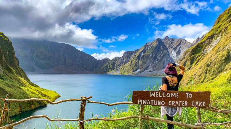
A journey to Mount Pinatubo Crater Lake is a generally amiable one. If you go with one of the companies offering tours, the excursion begins with a comfortable bus ride from Manila before transferring to a 4×4 for an off-road trip through the Crow Valley. From that point, you’re on foot, but it is a fairly flat walk along the dry riverbed, navigating a few streams along the way. The first leg of the route takes around two hours, followed by a little more exertion as you make a short ascent to the lake. This stage of the trip is marked by a friendly-looking sign in English suggesting how long it will take Further helpful signposts remind you to mind your step before you reach stunning Pinatubo Crater Lake, where there is a well-manicured viewing spot and even a gazebo to rest in.
In all, the trip is a straightforward stroll and the Crater Lake is a tranquil sight on a bright sunny day. But appearances can be deceptive: When Mount Pinatubo erupts, it is hell on earth.
The Philippines are in the Ring of Fire

Mount Pinatubo is a stratovolcano on Luzon, the biggest island in the Philippines, and around a two-and-a-half hour bus ride from the capital, Manila. On a larger scale, the Philippines is in the scary-sounding Ring of Fire, a zone of high tectonic activity that loops around the Pacific Ocean and is known for its regular earthquakes and over 450 volcanoes. Extending almost 25,000 miles, the Ring of Fire is home to around 75% of the world’s volcanoes.
In case you were wondering, a stratovolcano is what most of us imagine when we hear the word “volcano”; a dramatic cone-shaped peak with steep sides. They are also more likely to erupt compared to other types because their lava is sticky and slow-moving, which can cause a volatile build-up of gases.
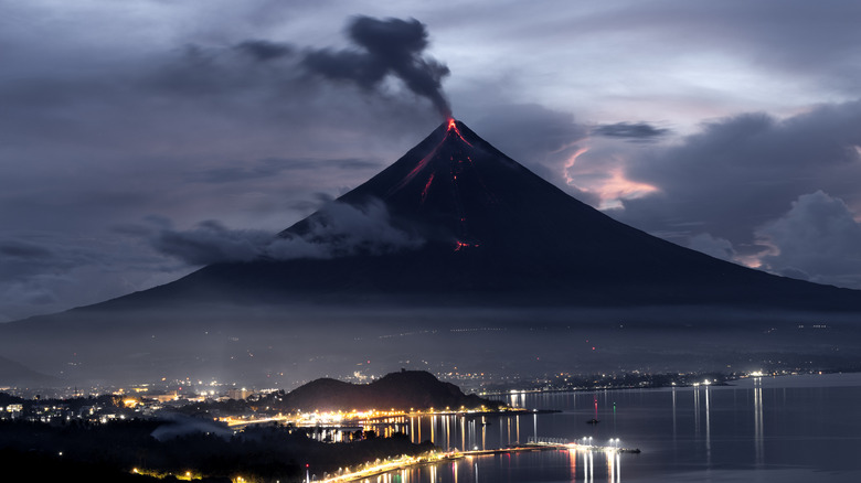
The Philippines is no stranger to deadly volcanic activity. Mayon, one of the most dangerous volcanoes on Earth, has erupted several times since 1993, causing deaths and the evacuation of thousands. In 2023, more volcanic earthquakes and pyroclastic flows were recorded at Mayon, resulting in further mass evacuations. In 2022 residents near Taal, another incredible active volcano, were ordered to seek safety when an eruption caused noxious gases and mud to rain from the sky. These incidents, however, were small compared to when Mount Pinatubo blew its top in 1991. It was the site of the largest volcanic eruption in the past 100 years, and the second biggest in the 20th century.
What happened when Mount Pinatubo erupted?

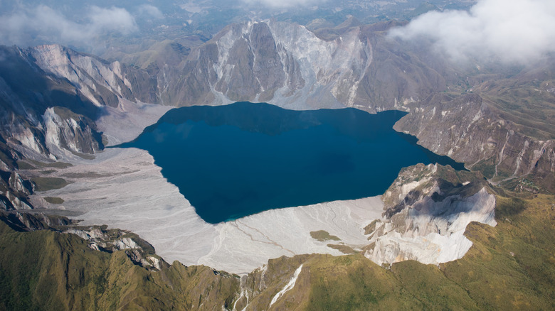
Although Mount Pinatubo was considered dormant for around 400 years before, disaster struck in 1991. Preceded by a series of earthquakes and smaller eruptions, the big one came on June 15 in a truly cataclysmic volcanic event. The main eruption blew the top of the volcano clean off, filling valleys, forming the crater we see today, and sending a vast plume of scorching ash over 20 miles into the air. Millions of people lost their homes and over 800 died. The eruption also wrought havoc on a wider scale, emitting an ash cloud blanketing 50,000 square miles and even affecting global temperatures and the Earth’s ozone layer. The devastation didn’t end there. Pinatubo erupted again the following year, this time killing over 70 more people.
In other words, trekking to Crater Lake is pretty easy but it isn’t the place to linger if the volcano decides to erupt once more. Even so, that shouldn’t deter you from taking the hike. While it’s impossible to fully predict when a volcano is likely to blow, they are being monitored. Thanks to the collaborative work between the U.S. Geological Survey and the Philippine Institute of Volcanology and Seismology, scientists were able to anticipate the worst in the run-up to the 1991 eruption and put an evacuation plan into motion, saving many thousands of lives. So enjoy the stroll, spare a thought for the unlucky ones, and keep an eye on the alerts, just in case.

