Terms about types of hikes
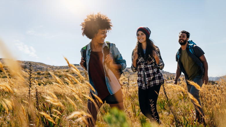
“Day hikes” are usually short to moderately long walks completed within one day. When it comes to trail configurations, there’s a flavor for every hiker. “Loop hikes“ start and finish at the same spot, delivering diverse views without déjà vu. “Out-and-back hikes” trek to a point, then U-turn. They’re easy to navigate and offer great lessons on perspective as you see the same trail from different directions. “Lollipop hikes“ begin and end straight and embark on a loop in the middle. The best of both worlds! “Shuttle hikes“ start at point A and end at point B, with transportation waiting. Some national parks even offer free shuttles to help facilitate these linear adventures. The “key swap“ reflects teamwork among hikers — two squads with opposite starting points. Midway, they exchange car keys, allowing each group to finish their journey where the other began.
“Backpacking“ is the art of living off your back, be it for one night or a dozen. Most backpackers carry food, water (and/or purifiers), and all the other gear they’ll need. It’s a great way to access terrain you can’t reach in just a day. If you’re craving a backpacking challenge that transcends the ordinary, consider a “thru-hike.” These take weeks or even months, journeying across long, established trails. Thru-hikers often plan stops in nearby towns or arrange for supply boxes to arrive at strategic points along the way. Iconic thru-hikes in North America include the Pacific Crest Trail and the Appalachian Trail.
Terms about trail types
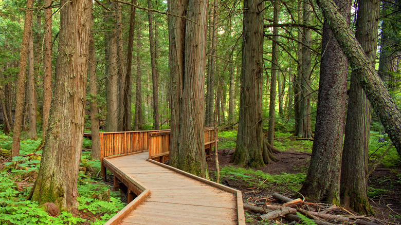
“Foot trails“ are the most basic type of trail, designed for pedestrian use. They come in various shapes and sizes — they might be dirt, gravel, or paved. Flat or steep. Long or short. Chances are there’s a foot trail to match your interest and ability level. “Boardwalks“ are flat wooden walkways often built in wetlands, marshy areas, or sensitive environments to protect the area while providing a stable path for walkers. These paths offer a safe way to explore areas that might otherwise be inaccessible. “Interpretive“ or “nature trails“ educate visitors about the area, usually with signage or exhibits along the route.
“Multi-use trails,” as the name suggests, accommodate multiple uses — walking, biking, and sometimes horseback riding. These trails are typically wider to support different types of users safely. “Fire roads” are also wide and usually unpaved roads created for fire access and control. Many fire roads are also open for use by hikers. But since fire roads are designed for vehicles, hikers may need to brace themselves for some steep trekking. When designed with hikers in mind, trails in steep areas often include switchbacks. “Switchbacks” create a zigzag pattern in a trail — instead of going straight up or down a hill, switchbacks weave back and forth, making the slope more gradual and manageable. And when you’re ready to find a good lunch spot, look for a “spur trail.” These short detours branch off the main path, often leading to a viewpoint or point of interest.
Terms about trail conditions
Spiderplay/Getty Images
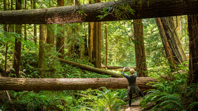
Storms can turn trails into unpredictable — and sometimes dangerous — adventures. A “blow-down trail“ refers to a path obstructed by toppled trees, often as a result of storms, wind, or natural decay. Hikers may need to navigate over, under, or around downed trees, creating a challenging trek. Storms also can create a “slog,” which is a difficult, often muddy or boggy section of a trail where progress is slow and laborious. The waterlogged ground forces hikers to trudge through with extra effort.
If you encounter a “washed-out trail,” proceed with caution! Washed-out trails are severely eroded, typically due to water flow from rain or melting snow. This erosion can make sections of the trail unstable or even impassable. The ground and trail features might have been carried away, leaving gaps or treacherous terrain. Sometimes you may even need to find an alternative route. Heed warning signs advising you to avoid a washed-out trail.
“Bushwhacking“ is not always about whacking bushes, though that’s part of its history. Sometimes bushwhacking means navigating an overgrown path of an existing trail. Originally, it meant battling through dense off-trail vegetation on an undefined path. Nowadays, bushwhacking is a catch-all phrase for off-trail adventures, even those that don’t require literal whacking of bushes. Keep in mind that venturing off-trail requires excellent navigation skills and a heightened awareness of the environment to minimize ecological impact. Some areas do not permit off-trail hiking because of these impacts and the inherent dangers of off-trail hiking.
Terms about trail etiquette
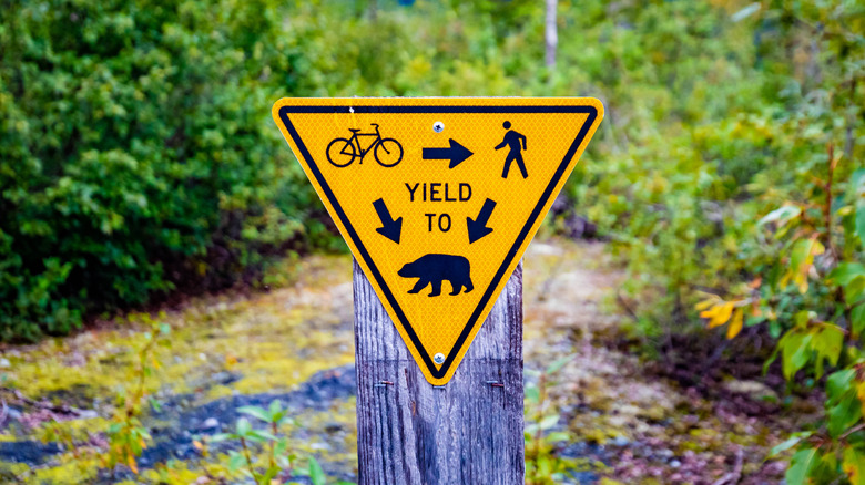
Photo Spirit/Shutterstock
Think of good hiking etiquette like driving — road rules help us enjoy our shared spaces safely. As with driving, “yielding“ is the act of giving way to others. Even without a bright yellow yield sign, hikers going downhill should yield to those going up. Climbing is tough, and maintaining momentum is key. However, if you’re ascending and need a breather, it’s okay to let a downhill hiker go first.
On multi-use trails, where bikers and horseback riders are added to the mix, it’s important to know trail expectations about “right-of-way.” Horses always have the right of way. If you’re on foot and see a horse, step aside and let the horse trot on. If possible, move downhill — this will help the horse feel less threatened. As for the non-equestrian encounters, hikers have the right-of-way over bikers. But even if “wheels yield to heels” is the motto, it’s often easier for a hiker to move over. Most hikers who see a bike coming will politely step aside.
Here’s the heart of trail etiquette: Mother Nature gets the ultimate right-of-way. “Leave-no-trace (LNT)“ emphasizes the importance of minimizing our environmental impact. “Leave only footprints, take only photos!” Avoid picking or trampling plants and dispose of trash properly. If there aren’t trash bins, take the trash back with you — “pack it in, pack it out.” This includes orange peels and your PB&J crust! Even these small bits can upset delicate ecosystems. LNT helps us protect these places we love to explore.
Terms about not getting lost
Sankai/Getty Images
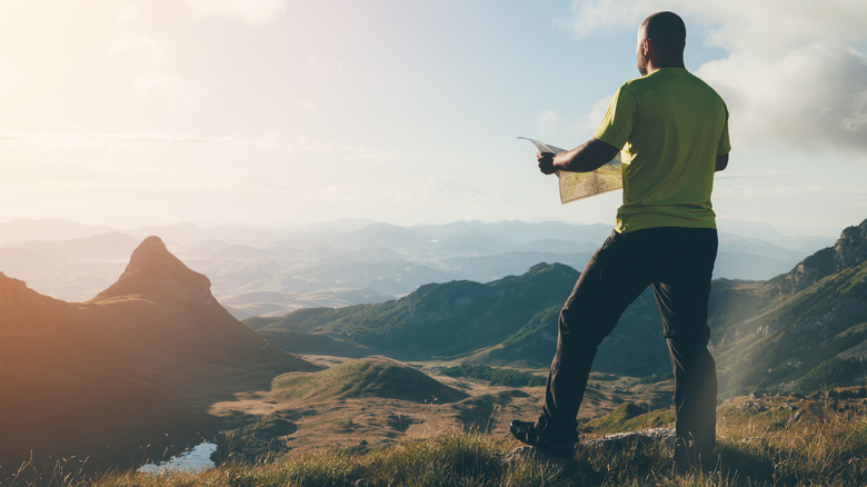
“Not all who wander are lost” is more than just a saying for hiking enthusiasts — it’s a way of life. Enjoy wandering with confidence, equipped with some hiking terms related to helping you keep your way. For starters, you’ll want a trusty “topo,” short for topographic map. But it’s not just a map! A topo map shows elevation changes and detailed features of the terrain, such as hills and rivers. This can help you choose routes and gauge a hike’s difficulty.
Once out on the trail, you might see blazes and cairns to help guide the way. A “blaze“ is a painted marking or carved notch found on trees, rocks, or the ground. When the path is trying to play hide and seek, these markings provide a clue to find the right path. A “cairn“ serves a similar purpose. Cairns are human-made stacks or piles of stones. They’re sometimes crafted by fellow hikers to help you navigate areas where the trail might be hard to find, such as snow or desert landscapes.
Even with clear trails, the wilderness can be unpredictable. That’s where a “personal locator beacon (PLB)” steps in. This nifty little device is like a panic button. Pressing it sends a distress signal via satellite, alerting rescue agencies about your location. If you’re heading into remote areas, challenging terrain, or out of cell service, consider carrying a PLB. With a PLB, you’re never lost, no matter how far you wander.
Terms about terrain and topography
Filippobacci/Getty Images
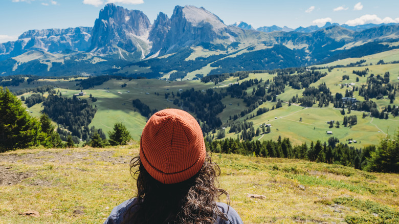
Terrain makes a big difference in how you experience a hike. “Altitude“ or “elevation“ tells us how high we are above sea level. Our bodies are likely to feel the change as we climb higher. Bring layers because as altitude goes up, the temperature tends to go down. Then there’s “elevation gain“ — the total amount of upward ascent that a hiker climbs throughout a hike. Understanding elevation gain provides a better indication of a hike’s difficulty than looking at mileage alone. Trails with significant elevation gain will be more strenuous. They require more energy and time than trails with minimal elevation changes. A short hike can feel endless if you’re continually going uphill …
But going uphill has its rewards! Hikers often set out to reach the “summit,” the highest point of a mountain. Reaching the summit can offer beautiful views and a sense of accomplishment. Along the way, you might enjoy hiking along a “ridge,” a long, elevated landform with steep sides that usually arise from the side of a mountain. Hiking along a ridge can also provide great views, but ridges are often exposed to strong winds and weather shifts. A “valley“ is a low area between hills or mountains. Hiking in valleys sometimes requires crossing streams or traversing through dense vegetation, forests, or meadows. A “plateau“ is a generally flat elevated area. The flat terrain makes it seem less strenuous, but plateaus can be at high altitudes, so be prepared for the associated conditions.
Hiking gear terms
Dimensions/Getty Images
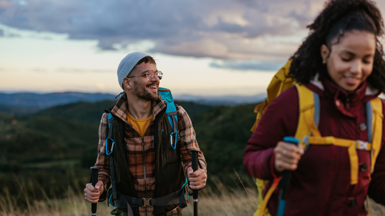
Forget the mountain of gear — with day hiking, you can enjoy the mountain with just a few essentials. Start from the ground up: invest in sturdy shoes or boots and then choose the right “base layer,” the clothing layer worn directly against the skin. This layer helps regulate your body temperature, keeping you snug in the cold and cool in the heat. Opt for “wicking” materials, which draw moisture away from the skin so you stay dry. Wet clothes aren’t just uncomfortable — they can be dangerous in colder climates. If you’re expecting puddles, snow, or dense underbrush, consider gaiters. “Gaiters“ are protective coverings that wrap around the lower legs to prevent mud, snow, and debris from sneaking into your boots.
Once you’re trail-ready, grab your “daypack,” a lightweight backpack with enough space for essentials like food and water. Throw in some “GORP,” which stands for “Good Old Raisins and Peanuts.” And make sure you have plenty of water to wash it down. Some hikers use a “hydration system” or “bladder.” Often made of rubber or plastic, a bladder is a flexible reservoir for holding water. It stays in your backpack, but with a small exposed hose so you can sip as you go.
Comfortable, fed, and hydrated, you might enjoy hiking with “trekking poles.” Resembling ski poles, trekking poles help you maintain balance and reduce strain on the knees and ankles. Additional points of contact on the ground enhance stability, especially on uneven trails.
Weather and climate terms for hikers
Swissmediavision/Getty Images
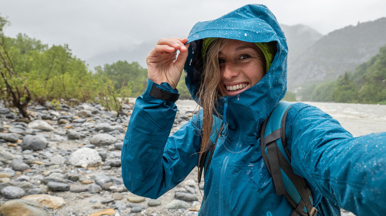
Weather can be fickle, so bring layers. “Microclimates“ are localized atmospheric zones that differ from surrounding areas. Many factors contribute to these varying climates, including the positioning of water bodies, vegetation, and the orientation of slopes. The wind direction and where you are on the mountain also make a big difference. The “windward“ side is the side of a mountain or hill facing the wind. It’s typically the wetter, cooler side. If you continue your journey and move to the opposite side, you’d be on the “leeward” side. This side is often drier and warmer.
A “cloud deck“ is a flat layer of clouds that sits just above the peaks. Enjoy its beauty — and also prepare for impending precipitation. Don’t let your guard down because of a “sucker hole,” which is a small, temporary break in the cloud cover. It might trick you into thinking the weather is clearing up, but it’s often just a brief break before the clouds return. And you never know when you might enjoy “sun showers,” a mix of sunshine and rain, and a perfect recipe for potential rainbows.
When hiking near the coast, prepare for a “marine layer.” This is a cool, moist air mass. It forms over the ocean and can move inland, often bringing fog or low-lying clouds. A marine layer can drastically change the temperature and visibility conditions of your hike.
Terms about hiking health and physiology

Artistgndphotography/Getty Images
You’re on a breathtaking mountain trail, each step bringing the exhilarating rush of high-altitude air. But as you climb, the thinning oxygen plays tricks on some of us: throbbing headaches, nausea, and gasping breaths of “altitude sickness.” It’s your body’s S.O.S., signaling it wants more oxygen. There are a few things you can do to help prevent altitude sickness. And the good news is the two basics are things a hiker should be doing anyway — stay hydrated and eat well. A third way to help prevent altitude sickness is through altitude acclimation.
“Acclimation“ is the process by which our bodies gradually adjust to changes in our environment. Instead of sprinting to the peak, savor the journey, allowing your body to sync with its surroundings. Think of it like dipping into a cold pool, one toe at a time. If symptoms of altitude sickness persist, get to a lower altitude or seek medical help.
Regardless of elevation, even picture-perfect trails can quickly turn torturous with the curse of a dreaded blister. Be prepared to fight a blister with a secret weapon: the mighty “moleskin.” This soft fabric backed with adhesive is like armor for your feet, shielding and healing those pesky blisters. Hopefully, you’ll never need to treat anything more than a blister on the trail — and hopefully not even that! But just in case, always carry a first-aid kit. Better to have and not need than need and not have.
Plant life terms on hikes
HannaTor/Shutterstock
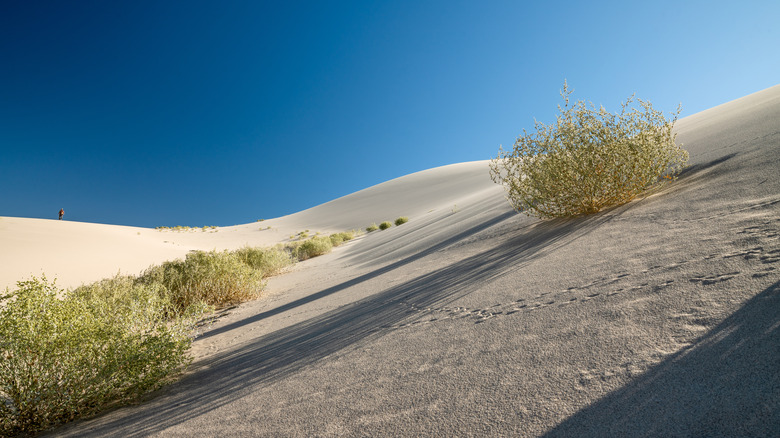
While you’re out hiking and enjoying the beautiful plant life, you might see both native and non-native species. “Native species“ evolved in a specific region over a long time, adapting to the climate, soil, and other environmental factors of that region. Local animals often rely on native species for food and shelter. Then there are the newcomers, the “non-native species” — plants that have been introduced to an area, whether accidentally or on purpose. Not all of these non-native species are bad, but some can get out of control and push out local plants. These are “invasive species” — they tend to spread rapidly as they disrupt local ecosystems. They threaten biodiversity and can even alter soil and water quality.
If you’re lucky, certain hikes might let you see endemic plants. “Endemic species” are unique to a specific location. They’ve adapted for growth in very specific conditions, making them especially vulnerable to threats like habitat destruction and invasive species. For example, the unique environment of Death Valley National Park is home to dozens of endemic species. A hike there means you’ll see some plant life that’s only found within the boundaries of the park. Contrast that environment with Yellowstone, where endemic plant life thrives on the park’s steamy thermal features. That hike would offer an entirely different experience, with a different set of endemic species to look out for.
App names you’ll hear on the trail

Hananeko_Studio/Shutterstock
So many trails, so little time. Want help deciding what trails to visit? AllTrails has thousands of reviews and photos sourced from a community of hikers and mountain bikers. Learn about hikes and trail conditions, see ideas for routes, and get access to thousands of trail maps. No matter the type of hike, AllTrails can help guide you.
Curious about that funky-looking insect or pretty wildflower? iNaturalist connects its users with a community of thousands of scientists and naturalists. Snap a photo and let the community help identify it. The app captures location data to include with your picture, letting you contribute to a global record of biodiversity. If you’re not interested in sharing your pictures, then Seek is for you. Point your phone at a plant or animal, and Seek will identify it. Developed by the folks at iNaturalist, Seek is great for kids because it requires no registration and doesn’t collect user data.
Seek and iNaturalist work great for things you can see — but what about all those birds you can hear but can’t see? That’s where Merlin comes in. Developed by the Cornell Lab of Ornithology, Merlin has a large database of bird calls. When you hear tweeting, hit record. Merlin will listen and try to identify the bird based on the sound. Birders say it’s like Shazam for bird songs. Be forewarned — it’s so fun that it’s easy to drain your phone battery, even on a short hike.
Hiking terms about using the bathroom
Angela Feltes/Shutterstock
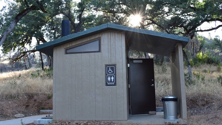
As the saying goes, “Any port in a storm.” The wilderness restroom option might be a “privy,” basically an outhouse in nature — a little shelter with a touch of privacy. You’ll probably have decent privacy with a “pit toilet“ or “vault toilet.” These can be permanent structures with lockable doors. The waste from pit toilets drops into a hole in the ground, while vault toilets store waste in sealed vaults that get emptied periodically.
Need to pee and you’re not near a toilet? Step off-trail to use the “green latrine” or “facilitrees.” Stay at least 200 feet from ponds or streams to keep water sources clean. It might be okay to pee in a large river that’s big and fast enough for dilution. If you’re in an alpine area where mountain goats roam, pee on a rock. Goats love the salt in our urine and dig up vegetation to get it.
For ladies, a “disposable urinal“ or “pee funnel“ is a tool to help you pee standing up. A bit of home practice goes a long way! If you use toilet paper, store it in a plastic bag and pack it out. Or, use a “pee rag,” a reusable cloth to replace toilet paper. An old bandana works. Or you can buy an antimicrobial, absorbent cloth. Either way, use it, then hang it on your pack to dry. The Charmin slogan, “Enjoy the go,” applies here … enjoy the trails and whatever comes along.

